- Home
- Brisbane Water National Park
8 Best Brisbane Water National Park Walks
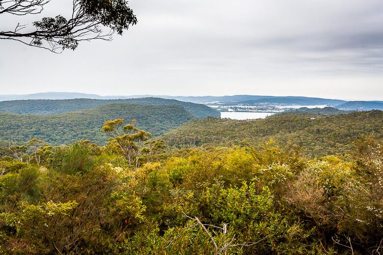
Brisbane Water National Park on the Central Coast covers an area of 12,000 hectares.
It's well known for the popular Great North Walk that runs through it.
Don’t want to do the whole Great North Walk?
Check out some of the shorter bushwalks in Brisbane Water National Park I have listed below. They don’t require any particular bushwalking experience, are under 8 kilometres return and take at most 5 hours.
Some are much shorter and are great to take kids along.
1. Girrakool Loop Walking Track
Distance: 2 kilometres
Duration: 45 min
Difficulty: Easy
The first three walks I list on this post start from Girrakool Picnic Area. You can combine them to form a 9.2-kilometre walk because the tracks all join up.
The picnic area contains picnic tables, barbecues and toilets.
The only thing I dislike about this place is the noise of traffic coming from the freeway.
But the noise fades once you move away from it on the Piles Creek loop or Mooney Mooney nature walk. The sound of cascading water and birds then take over, and it’s a nice respite.
Girrakool loop track is the shortest walk located at Girrakool Picnic Area.
It’s well sign posted.
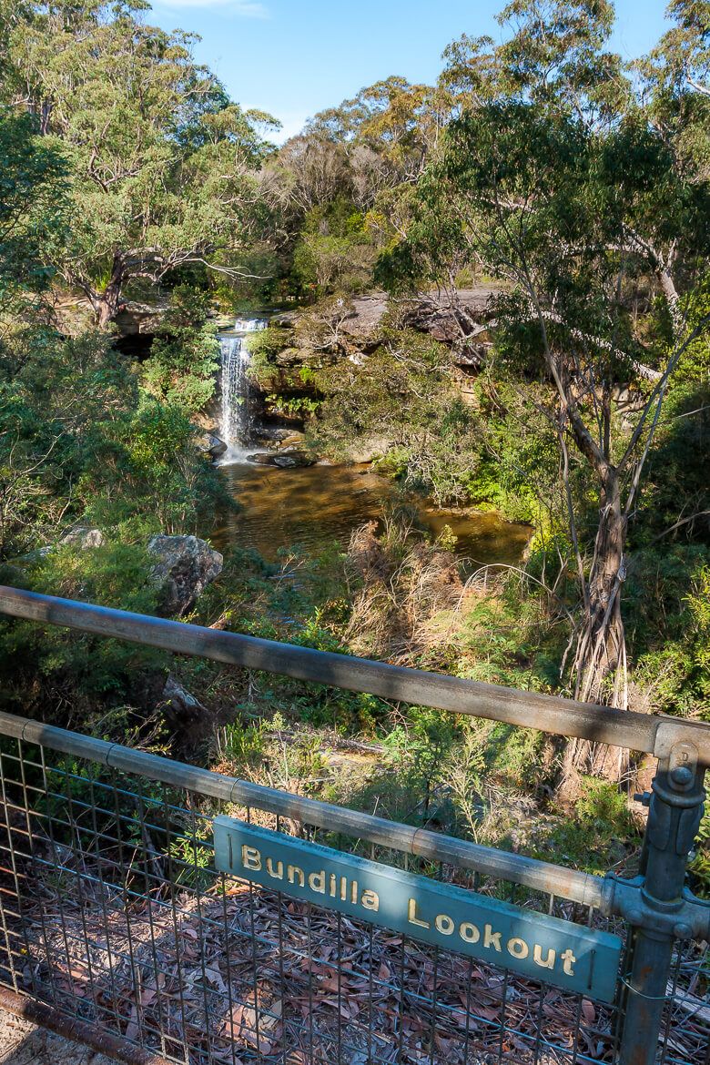
The track leads to an Aboriginal engraving site and a few lookouts overlooking small waterfalls.
The Aboriginal engravings are faded and difficult to see, but you can see a man and a kangaroo.
It’s a perfect walking track for young children because they can experience Aboriginal rock art and see waterfalls while walking a short distance.
After passing the Aboriginal rock engraving site, you arrive at Broula Lookout where you get filtered views of a small waterfall. It’s a great spot to stop for a rest or a snack. The sound of cascading water is soothing.
Then hike past Illoura Lookout, Bundilla Lookout and Andamira Lookout.
Park at Girrakool Picnic Area, Girrakool Road, Somersby. Parking is $8.
2. Piles Creek Loop
Distance: 4-kilometre loop
Duration: 2hrs 30min
Difficulty: Hard
Piles Creek Loop is one of the best hikes on the Central Coast. You walk up and down the whole way, so it's a great workout.
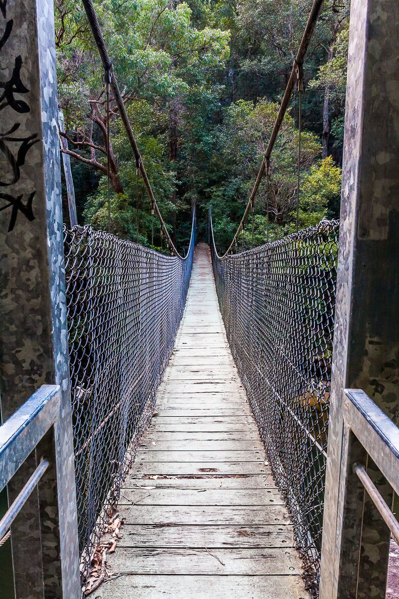
The track passes rock ledges, a creek with cascading water and a cool suspended bridge.
The walk continues along escarpments with the relaxing sound of cascading water in the background.
They advise you have navigational skills to do this hike. For most of the way the track is easy to see, But sometimes it becomes less obvious.
Wear good non-slippery walking shoes.
Parking at Girrakool Picnic Area, Girrakool Road, Somersby. Parking is $8.
READ MORE: Piles Creek loop
3. Mooney Mooney Nature Walk
Distance: 8.4 kilometres return
Duration: 5 hrs
Difficulty: Hard
Mooney Mooney Nature Walk overlaps with Piles Creek loop between the suspended bridge and Girrakool Picnic Area.
This section is hard because you walk up and down the whole way. It’s beautiful, though – you walk along escarpments with the sound of cascading water in the background.
Past Phil Houghton Bridge the walk takes another direction. It becomes easy and well sign posted.
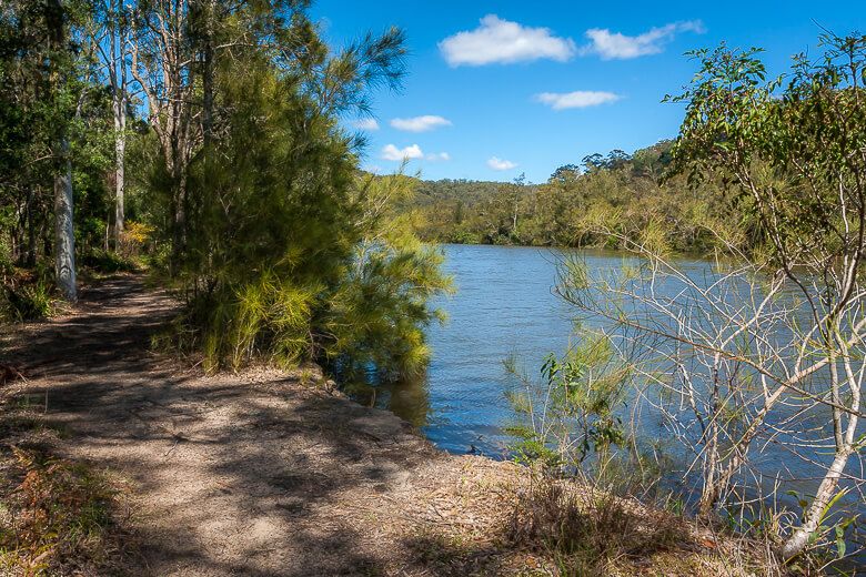
The track follows the untouched Mooney Mooney Creek. We could hear bellbirds. It’s a relaxing section.
Park at Girrakool Picnic Area, Girrakool Road, Somersby. Parking is $8.
4. Patonga to Pearl Beach Walking Track
Distance: 6 kilometres return
Duration: 3 hrs
Difficulty: Hard
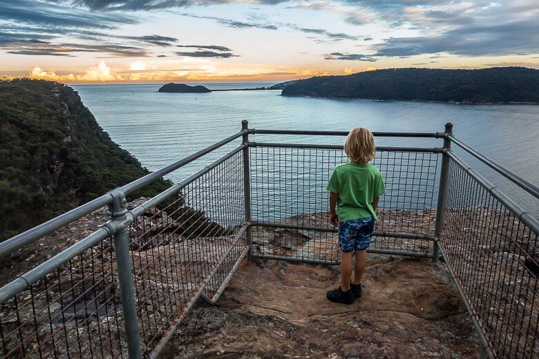
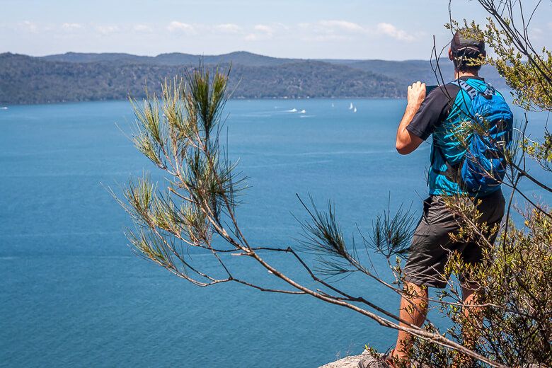
This is a popular walk in Brisbane Water National Park between Pearl Beach and Patonga over a headland via the scenic Warrah Lookout.
The walk is rated hard because you must walk up the headland and down, but it's worth it.
The views of the Hawkesbury River and the Northern Beaches are stunning. You can see sailing boats dotting the river far below.
Start the walk either from Pearl Beach or Patonga. Both villages are lovely and you can have a swim at the beaches.
Park on Crystal Ave, Pearl Beach (enter 67 Crystal Ave in your GPS and drive a bit further to the small car park on the right).
Or park along Patonga Drive if starting at Patonga (enter 8 Patonga Drive in your GPS). The walk begins at the eastern end of the beach.
READ MORE: Patonga to Pearl Beach walking track
5. Warrah Trig to Warrah Lookout
Distance: 800 metres return
Duration: 30 min
Difficulty: Easy
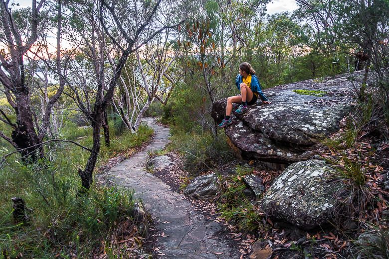
Enjoy a lovely shortcut to Warrah Lookout.
You could also continue walking to Patonga or Pearl Beach from Warrah Lookout.
Park at the end of Warrah Trig Road and follow Doyles track.
6. Somersby Falls
Distance: 500 metres return
Duration: 15 min
Difficulty: Medium
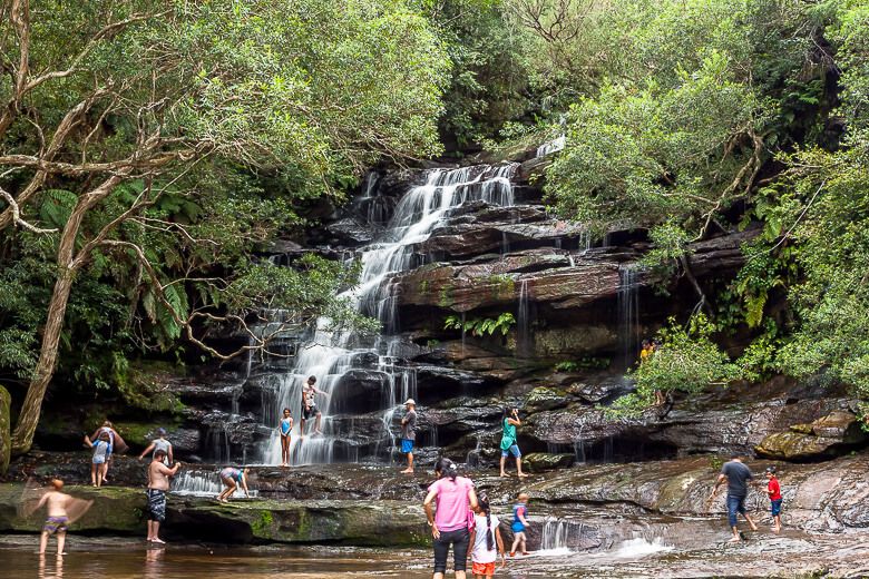
The popular walk leads to two beautiful waterfalls. The walking track winds steeply downhill through dense rainforest.
The most beautiful waterfall sits mid-way along the track. The walk leading to it is technically easy because of the stairs.
Kids like to play in the puddle at the fall's base, and some people like to stand under the falling water.
The last waterfall at the bottom of the hill is smaller. The pathway leading to it goes over wet rocks so it can be slippery. Wear non-slippery walking shoes.
It’s a great spot to visit during a hot summer day as the dense forest keeps you cool.
Park on Somersby Falls Road, Somersby (enter 265 Somersby Falls Road in your GPS). Parking is $8. Or park for free along the road before entering the formal car park.
READ MORE: Somersby Falls
7. Kariong Brook Falls
Distance: 4.6 kilometres return
Duration: 1hr 30 min
Difficulty: Medium
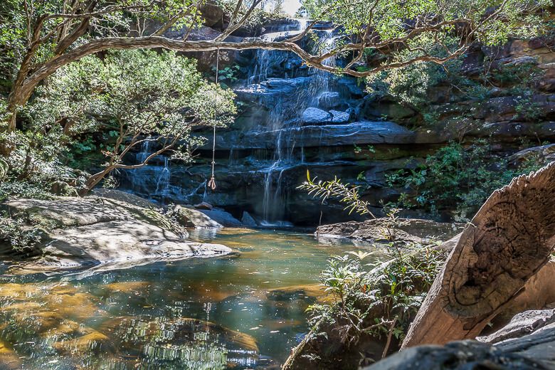
This walk makes you feel away from everything. You get nice views of valleys and hills and only hear the wind and birds chirping.
The large trail lets the sun rays infiltrate the path.
Walking along the Tommos Loop trail is easy but gets harder along the narrower track leading to Kariong Brook Falls.
The descent is worth it. When you're nearly there, you see the waterfall from higher up on the escarpment. The waterfall plunges into a deep rock pool surrounded by rock ledges, and it looks like an enchanted world.
To get there, follow Tommos Loop Firetrail for 2 km and turn right at the sign post indicated “Girrakool”. This track descends over boulders for 300 metres.
Park in the small car park along Woy Woy Road, 350 metres south of Staples Lookout.
READ MORE: Kariong Brook Falls
8. Bulgandry Aboriginal Art Site
Distance: 600 metres return
Duration: 15 min
Difficulty: Easy
Bulgandry Aboriginal Art Site is a 10-minute walk leading to a large rock showing many Aboriginal engravings.
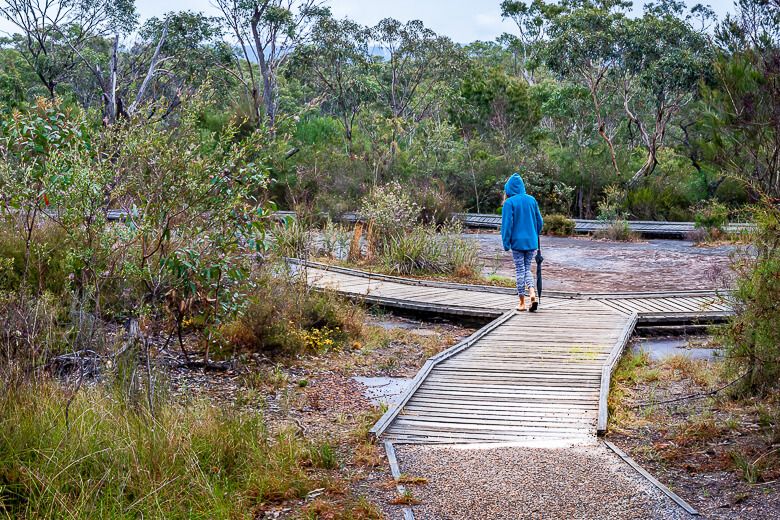
The Aboriginal engraving rock is right at the end of the walk so you can’t miss it. A boardwalk surrounds the engravings.
The walk is suitable for prams and wheelchairs.
The engravings are very clear and have written descriptions, so you know what you're looking at.
The drawings are in excellent condition, amazing considering they're at least 200 years old.
Park along Woy Woy Road, about 3 kilometres from the intersection of Central Coast Highway and Woy Woy Road in Kariong. It’s free to visit.
READ MORE: Bulgandry Aboriginal Art Site
Also, Visit Staples Lookout...
Staples Lookout overlooks wide
expanses of bush and Brisbane Water at a distance. There are picnic tables beside the lookout.
Located on Woy Woy Road in Brisbane Water National Park, 5 kilometres from the intersection of Central Coast Highway and Woy Woy Road in Kariong.
There are sign posts along the road.
